Future of South Walton Mobility: Key Findings
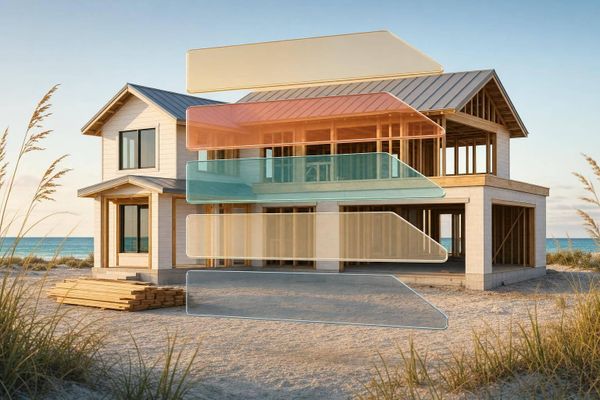
Making short beach trips easy—park once, use frequent shuttles; infrastructure and hubs matter more than flashy vehicle tech.
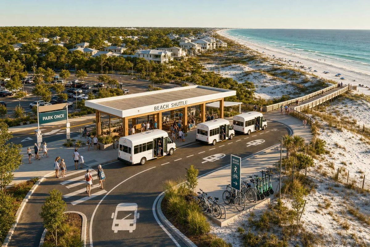
South Walton’s main mobility answer is simple: get more people out of cars for short 30A trips. I found that the local research keeps pointing to the same setup - park once, use hubs like Grayton Central, and rely on frequent shuttle service instead of trying to add road lanes.
If you want the short version, here it is:
- 30A and Scenic 98 have little room for road expansion
- Shuttle success depends on frequency, wait times, and stop locations
- Peak-season demand is the main reason this plan matters
- Free or low-cost short-loop service fits visitor travel patterns best
- Autonomous shuttles may work later, but only on simple, low-speed routes
- The road and hub setup matters more than the vehicle type
A few numbers stand out. Walton County saw 1.33 million visitors and 1.03 million room nights in Spring 2024. Peak 30A traffic can hit about 10,000 vehicles per day. And if shuttle service pulled just 10% of those peak trips, it could mean around 1,000 riders per day.
What I take from the research is pretty direct: <u>this is less about flashy transit ideas and more about making short local trips easy enough that people stop driving them.</u> That means 10–15 minute headways, long daily service hours, simple loops, strong links to parking hubs, and a setup that can scale up in summer and scale down later.
Here’s the fastest way to look at it:
| Topic | Main finding |
|---|---|
| Road limits | 30A and Scenic 98 cannot add many car lanes |
| Best travel model | Park once, then use shuttle, bike, or walk |
| Main hub focus | Grayton Beach, Scenic 98/US 98, and Watersound Origins |
| Best shuttle format | Short, simple, fixed routes |
| Peak-season need | High, due to traffic, parking pressure, and visitor volume |
| Best service level | About 10–15 minute service with long daily hours |
| AV shuttle fit | Best for short, fixed, low-speed segments |
| Main risk | Weak frequency, weak coverage, or poor hub links |
So before getting into route ideas, demand, and shuttle types, the main point is clear: South Walton mobility will depend on whether the county can make park-once travel easy, frequent, and easy to understand.
Smart, electric and autonomous: welcome onboard the ultimate ‘last-mile’ shuttle bus
sbb-itb-d06eda6
South Walton's mobility plan for 30A and Scenic 98
Walton County's 2040 Mobility Plan treats 30A and Scenic 98 as multimodal corridors built around park-once travel. For shuttle planning, that matters a lot. The main question is simple: where can one parked car replace a string of short local drives? That change is the basis for future shuttle and autonomous shuttle service on 30A. It also shapes where shuttles can operate and how riders would get to them.
Scenic corridor rules tighten the picture even more. Landscape buffers, height limits that protect views, and stricter signage all limit how much the roadway can be widened.
Mobility hubs and park-once travel
The plan points to three Regional Mobility Hubs along the 30A and Scenic 98 corridor:
- Grayton Beach
- the US 98–Scenic 98 intersection
- Watersound Origins north of US 98
These regional hubs are backed by community mobility hubs at Gulf Place, Blue Mountain Beach, and Seagrove Beach, among other places. In plain terms, these spots work like handoff points. People park once, then switch to another way of getting around.
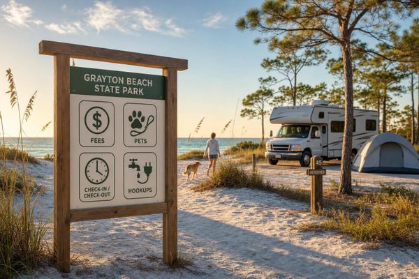
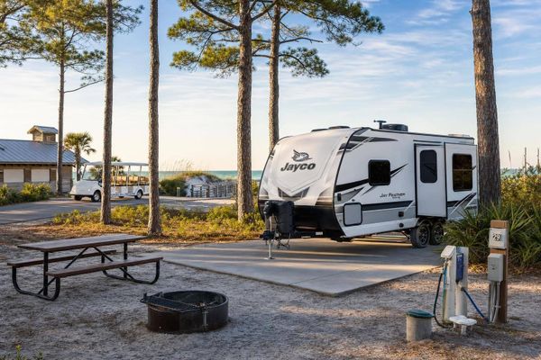
Grayton Central shows what that can look like on the ground. The site covers nearly 7 acres and includes 204 standard spaces, 7 low-speed vehicle spaces, and 4 EV charging stations. From there, a visitor could transfer to a shuttle running every 10 minutes from 6:00 a.m. to 9:45 p.m. Put together, these hubs form the transfer network shuttle routes would need to serve.
Street changes that affect shuttle feasibility
The street design matters just as much as the hubs. On Scenic 98, the plan expands the 8-foot path to at least 12 feet and adds 6-foot multimodal lanes on both sides, with separation from both pedestrians and vehicles. That kind of setup can make shuttle movement more steady and less tangled with foot traffic.
On 30A, the Seaside segment proposes a 16-foot bi-directional dedicated multimodal lane on the Gulf side for micromobility and microtransit, along with a widened 12–14-foot path on the north side for pedestrians and cyclists. The design also narrows travel lanes and drops speeds to about 25 mph in urban areas and 15–25 mph in multimodal lanes.
That speed change is a big deal. Lower speeds and separated lanes would give shuttle vehicles and autonomous shuttles more predictable operating conditions. Those corridor changes lay the groundwork for the route ideas and seasonal service patterns that come next.
Proposed shuttle routes and microtransit concepts
Walton County's 2040 Mobility Plan and related technical documents lay out a two-phase microtransit circulator. Phase 1 focuses on 30A. Phase 2 extends north to US 98 activity centers. The idea is pretty simple: give people a way to make short trips without adding more cars to an already crowded corridor.
30A circulators and connections to US 98
At the center of the proposal is a circulator loop along 30A, US 98, CR 83, and CR 393. It would connect Blue Mountain Beach, Gulf Place, Santa Rosa Beach, and shopping and service areas on US 98. In practice, that means easier movement between beach communities and daily errands, without having to drive from stop to stop.
This plan isn't coming out of nowhere. Parts of that same setup already appear in the county's Beach Park and Ride network. The current service gives riders 10-minute headways between Grayton Central, Blue Mountain, 393 Beach Park and Ride, and nearby beach accesses. People can switch between hubs and reach several spots without moving their car, which is exactly the kind of short-trip use case this larger system is meant to serve.
Planning documents call for a mix of golf carts, neighborhood electric vehicles (NEVs), trolleys, and autonomous shuttles, with the fleet sized to demand and budget. That kind of range gives the county room to match the vehicle to the trip instead of forcing one format onto every route.
How route design addresses seasonal travel patterns
The case for this service gets a lot stronger in peak season. Traffic on 30A can reach 10,000 vehicles per day, putting the road at or above two-lane capacity. A 2016 traveler survey found that 58.3% of visitors avoided shops or restaurants along 30A because of traffic. That's a big clue. When congestion starts changing where people go and what they skip, a shuttle stops being just a nice extra and starts looking like a practical option.
The proposed service is built around that seasonal swing. Planning documents say frequency, fleet mix, and service levels would change with visitor volume, with more frequent trips in peak months and less service in the off-season. The State Park Express already uses that same seasonal pattern. It targets congestion around Grayton Beach State Park and runs from Memorial Day through Labor Day, with 30-minute service.
The ridership math also helps explain the push for frequent service. If the system captured 10% of 30A's peak-season trips, that would amount to about 1,000 passengers per day. For a short-hop circulator in a busy beach corridor, that's enough demand to support a frequent, easy-to-use service.
Key findings on shuttle demand, rider use, and service design
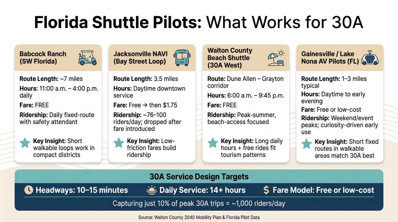
South Walton 30A Shuttle Pilots: Key Stats & Service Comparison
Demand drivers for 30A shuttle service
Planning documents point to a pretty clear set of trips for a 30A microtransit circulator. The biggest demand comes from beach access, trips between lodging and retail, worker commutes, and first- and last-mile links to regional transit.
Seasonality makes that demand even sharper. On peak Saturdays in June and July, parking hubs such as Grayton Central usually fill up if visitors get there after 9:30 a.m. That creates a strong park-once-and-ride case for shuttle service.
Florida pilot programs also give a good picture of what tends to work in short corridors with lots of visitors.
What Florida shuttle pilots suggest for 30A
Across Florida, autonomous and microshuttle pilots tend to look similar: short fixed routes, moderate frequency, and free or very low-cost rides. For 30A, that matters. This corridor is short, linear, and easy to understand, so the closest matches are the pilots built around simple loops and easy boarding.
| Pilot | Route Length | Operating Hours | Ridership Pattern | Fare | Key Takeaway for 30A |
|---|---|---|---|---|---|
| Babcock Ranch (SW Florida) | About 7 miles mapped | 11:00 a.m.–4:00 p.m. daily | Daily fixed-route service with a safety attendant on board | Free | Short, walkable loops are a workable model for compact districts |
| Jacksonville NAVI (Bay Street loop) | 3.5 miles | Daytime downtown service | About 76–100 riders/day; ridership dipped after a $1.75 fare was introduced | Initially free, then $1.75 | Low-friction fares can help build ridership |
| Walton County beach shuttle (30A west) | Dune Allen–Grayton corridor | 6:00 a.m.–9:45 p.m. on the A–B route | Peak-summer, beach-access focused | Free | Long daily spans and free rides fit tourism travel patterns |
| Gainesville / Lake Nona AV pilots (FL) | 1–3 miles typical | Daytime to early evening | Weekend and event peaks; curiosity-driven initial use | Free or low-cost | Short, fixed routes in walkable areas are the closest match for 30A |
The pattern is hard to miss. The pilots that line up best with 30A rely on short, easy routes, broad daily service windows, and little to no fare barrier. That fits the way people move in a beach corridor, where many riders are visitors and many trips are short.
Service features most likely to influence ridership
Ridership tends to respond more to service quality than to fare alone. Even so, removing fares can increase use by about 49% to 55% when the service itself is already good. That kind of setup also fits short, predictable loops, which is the type of service autonomous electric shuttles handle best.
For 30A, the Okaloosa–Walton 2045 Long Range Transportation Plan ties microtransit performance to 10–15 minute headways, at least 14 hours of daily service, and seasonal shifts in fleet size and frequency. Walton County’s summer beach shuttle already works much like that. Its A–B route to Grayton Beach runs every 10 minutes from 6:00 a.m. to 9:45 p.m., while the Gulf Place and Dune Allen routes run every 10 to 15 minutes during service hours. In plain terms, the county already has a working example of how a larger 30A shuttle system could add frequency in peak season and scale back when demand drops.
Route design matters too. Studies tie higher ridership in tourism-heavy corridors to simple alignments and direct links between parking hubs, beach access points, and lodging or dining areas. That makes sense. Visitors are far more likely to ride a shuttle when they can understand it at a glance and when it mirrors the trips they already plan to take along 30A.
Those same features - simple routes, short trips, steady frequency, and direct stop spacing - are also the main test for whether autonomous electric shuttles fit 30A well.
Autonomous electric shuttles on 30A: likely benefits, limits, and next steps
Where autonomous electric shuttles could fit on 30A
Autonomous electric shuttles make the most sense on 30A as a support layer for short, fixed trips between parking hubs and beach access points. That lines up with local planning, which places them inside a broader microtransit network. Grayton Central stands out as the clearest early pilot location because it already has parking, EV charging, and shuttle access.
County plans also highlight the 30A Mobility Innovation Corridor between CR 283 and CR 395. If that corridor gets separated multimodal lanes, it could handle low-speed shuttle service in the 15-25 mph range. That matters because these vehicles tend to do best when the route is simple, mapped in advance, and not full of unpredictable conflicts.
Advantages and limits shown by plans and pilots
The big upside is efficiency. The hard part is day-to-day operations.
Florida and U.S. pilots show the same pattern: autonomous shuttles work best on short, predictable routes, and they get harder to run in mixed traffic. For 30A, that points to a pretty clear use case. Simple trips between hubs, beach access points, and town centers are a better fit than long, stop-heavy routes with lots of turning movements.
| Factor | What the plans and pilots suggest for 30A |
|---|---|
| Safety | Low-speed, geofenced service shows up often in pilots, but busy corridors with pedestrians and cyclists still call for strong sensor performance, clear markings, and lane separation. |
| Capacity | Walton County documents describe autonomous transit shuttles as 12-passenger vehicles, so good service likely means multiple shuttles running at high frequency. |
| Service design | Frequent, fixed service on pre-mapped corridors, with seasonal service levels adjusted to demand. |
| Flexibility | Fixed corridors are the best fit; seasonal demand is easier to handle by changing frequency and fleet size. |
| Emissions | Electric shuttles can cut local tailpipe emissions and noise, but that payoff depends on strong ridership and good links to walking and biking. |
| Infrastructure | Existing hubs like Grayton Central help, but dedicated multimodal lanes, safe crossings, and more hubs are still important next steps. |
| Community acceptance | Riders often report high confidence after using the service, but comfort with driverless service is often low before launch. |
One point stands out: people tend to like the service more after they try it. Before launch, though, skepticism is common. On 30A, early service would likely need onboard attendants, clear signage, and active public communication so riders know what to expect.
Conclusion: Key takeaways for visitors and future residents
Those limits shape the near-term rollout more than the vehicle tech itself. Walton County's plans point toward a park-once, multimodal network that includes autonomous shuttles. But none of that scales without the physical setup to support it. Mobility hubs, dedicated multimodal lanes, and grant-backed planning still have to move forward first.
For visitors planning a trip now, the practical takeaway is simple: the park-once model is already happening at hubs like Grayton Central. Across this article, the same finding keeps coming up: infrastructure and service design matter more than the label on the vehicle. For updates on shuttle planning, hub locations, and mobility changes, sowal.co tracks South Walton developments.
FAQs
How would park-once travel work on 30A?
Park-once travel on 30A means you park your car at set inland transit hubs, then use free shuttles or trams to reach beach access points and nearby spots.
The idea is simple: put parking in places like 393, Grayton Beach, and Ed Walline so visitors don't have to circle around looking for limited roadside spaces. Once you've parked, you can move around by shuttle, on foot, or by bike. During peak times, paid parking may be used to help manage demand.
Why are shuttles favored over adding road lanes?
Shuttles are popular because they support a park-once model. That means people can leave their cars at inland hubs and get around without adding more pressure to South Walton’s scenic roads and neighborhood streets. Put simply, this approach helps protect the area’s character instead of pushing toward more road widening.
By keeping parking centered inland, shuttles can cut down on cars circling for open spots and lower the safety issues that come with roadside parking. They also work well alongside walking and biking, giving South Walton a smarter, lower-cost way to ease congestion.
When could autonomous shuttles realistically launch?
There is currently no published date or timeline for autonomous shuttles in South Walton.
Instead, public mobility plans through 2030 focus on a phased rollout of human-operated microtransit, the Park Once strategy, Beach Park and Ride service, and street and transit upgrades like low-speed vehicle lanes and transit hubs.