Story of Seaside, Florida
How an 80-acre parcel became a pedestrian-first beach town on 30A, shaped by a compact layout and lasting design rules.
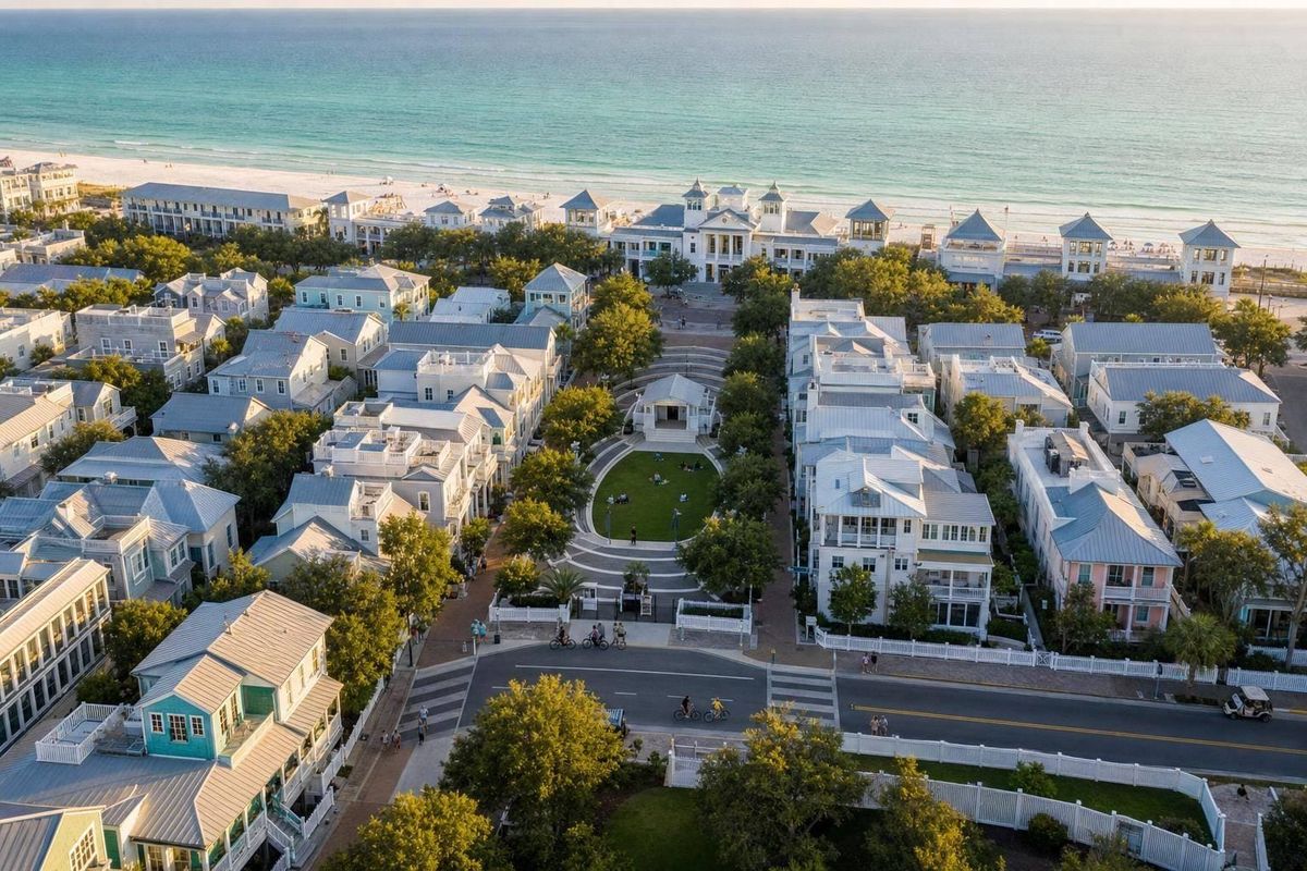
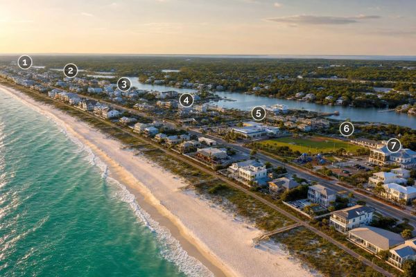
Seaside became one of 30A’s best-known towns because it was planned around walking from the start. I’d sum it up this way: an 80-acre family parcel turned into a small beach town with homes, shops, public space, and beach access set close together, and that early plan still shapes the town now.
If you want the short answer, here it is:
- Where it is: Seaside sits on Scenic Highway 30A in South Walton County in Florida’s Panhandle.
- How it started: Robert and Daryl Davis used inherited family land instead of dividing it into standard beach lots.
- Who planned it: Andrés Duany and Elizabeth Plater-Zyberk helped map the town.
- What made it different: Walkable blocks, a mixed-use center, and rules for porches, setbacks, and lot placement.
- When it began to take shape: The first homes were built in 1981.
- Why people know it now: The town kept its small scale and street pattern as it grew.
What stands out to me is how much came from a few early choices. Put daily life within walking distance. Keep public spaces at the center. <u>Use design rules to hold the town to the same plan over time.</u> That is the main story.
| Topic | Short answer |
|---|---|
| Starting land | 80 acres |
| Main idea | Pedestrian-first beach town |
| Core layout | Homes, square, amphitheater, shops, and beach close together |
| First homes | 1981 |
| Lasting result | A steady town form that made Seaside a major stop among what each 30A town offers |
So if you’re asking why Seaside looks and feels different from many beach developments nearby, I’d say it comes down to one thing: it was planned as a town, not just a group of lots.
Seaside's 45th anniversary marks a legacy of coastal charm
sbb-itb-d06eda6
The Origins of Seaside and the People Who Built It
Seaside started as family land before Robert and Daryl Davis turned it into a planned coastal village.
From J.S. Smolian's Land to Robert and Daryl Davis's Vision
The land that became Seaside was an 80-acre parcel first owned by the Smolian family. Robert Davis inherited it, and he and his wife, Daryl Davis, decided to shape it as a compact, pedestrian-first village instead of splitting it into standard beach lots. That parcel became the starting point for one of 30A's most influential town plans. This development marked a significant shift in how 30A towns evolved from simple coastal land into planned communities.
Their idea came from memories of simple coastal places with an easy rhythm to them. So the plan focused on a walkable town center, an amphitheater, and short, easy routes to key spots.
How Andrés Duany and Elizabeth Plater-Zyberk Joined the Project
To turn that idea into a built plan, the Davises brought in Andrés Duany and Elizabeth Plater-Zyberk. Their design pushed Seaside's walkability, mixed use, and village-scale layout.
Porches and tight setbacks helped give the streets a shared look and a close-knit feel. Those choices shaped the master plan that followed and helped define how Seaside's architecture reflects local history through its streets, blocks, and public spaces.
The Master Plan That Set Seaside Apart
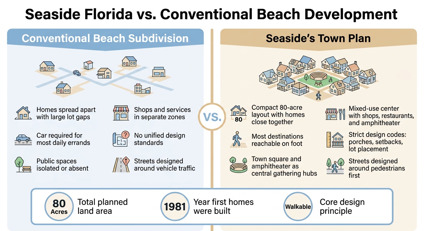
Seaside Florida vs. Conventional Beach Development: Town Planning Compared
Duany and Plater-Zyberk turned the Davises' idea into a master plan that gave the town its shape from the start. They took a family land parcel and mapped it as a real coastal town where people could handle daily errands on foot instead of getting in the car. That setup guided the first homes and set the pace for Seaside's early growth.
Walkable Blocks, a Mixed-Use Center, and a Compact Layout
Seaside was planned as a compact village, with most cottages just a short walk from the town center. And that center isn't just a landmark on a map. It pulls together the amphitheater, restaurants, and shops, which means coffee, dinner, and local events sit close to each other.
The result is simple but powerful: the beach, the shops, and the center of town all fit into the same everyday path. Instead of places being spread out, they connect in a way that makes walking feel natural.
Design Rules, Porches, and Streets That Shaped Daily Life
Seaside's shared look didn't happen by accident. It came from design rules that set details like setbacks, porch depth, and where buildings sit on their lots. Those standards work alongside Walton County rules and help keep the town aligned with its original plan.
That mattered as soon as the first cottages went up. The rules shaped more than architecture on paper; they shaped the streets, the porches, and the way people moved through town each day.
Conventional Coastal Pattern vs. Seaside's Town Plan
Seaside's plan changes the feel of daily life. A typical beach subdivision often spreads homes apart and separates them from stores and public gathering spots. Seaside does the opposite. It groups homes, shops, and public space around one walkable center, so the town works as a connected place instead of a string of isolated properties.
First Homes, Early Streets, and the First Growth Phase
The First Homes Built in 1981
The plan started to become real in 1981. That year, Seaside’s first cottages were built, turning the master plan into an actual neighborhood.
Those early homes shaped the New Urbanism in South Walton that followed. They set Seaside’s pastel color palette and its small-scale village feel, which gave the town its early identity.
How Early Recognition Helped Seaside Grow
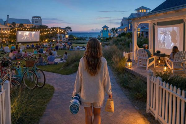
As more homes were added, Seaside kept to its early pattern. The town square and amphitheater became the center of daily life, while cottages remained a short walk from shops and restaurants.
At the same time, design standards helped protect the original scale. So even as Seaside grew, it held on to the same small-town feel that marked it from the start
How Seaside Became a Major Stop on 30A
From Small Resort Town to Regional Destination
As Seaside grew, its original plan started drawing attention far beyond its first footprint. What began as a planning experiment in the Florida Panhandle became one of the most recognizable towns on 30A.
A big part of that came down to the town's rules. Those codes kept Seaside's scale in check as new buildings and spaces were added. Instead of drifting away from the first idea, the town kept its shape and feel. Over time, that steady sense of place helped turn early attention into lasting appeal.
What Seaside Offers the South Walton Experience Today
That same layout still guides day-to-day life. Visitors can still walk from the beach to the shops to the amphitheater without much effort, which gives the town an ease that's hard to miss.
Seaside still works much like its founders intended. That kind of consistency matters. It helps explain why so many people come back again and again for the South Walton experience.
Conclusion: The Key Decisions That Shaped Seaside
Seaside's rise came from a handful of deliberate choices. A pedestrian-first plan, design codes that kept the town tied to its original scale, and a layout that allowed growth without losing its character all built on each other over time.
Those decisions helped turn a small coastal plan into one of 30A's defining places.
FAQs
Why was Seaside planned around walking?
Seaside was planned for walking, with the goal of building a stronger sense of community and connection. By keeping the town to 80 acres and placing homes, shops, and daily amenities within a quarter-mile, the plan made it easy for residents to cross paths in day-to-day life.
The street layout supports that idea. Narrow, pedestrian-friendly streets slow traffic, while homes sit close to the street and garages are tucked behind the houses. The result is a town that puts people first instead of leaning on car-heavy suburban design.
How did Seaside’s design rules shape the town?
Seaside’s design followed the Seaside Code, written by founders Robert and Daryl Davis with architects Andrés Duany and Elizabeth Plater-Zyberk. The code pushed a pedestrian-first plan built around a compact, mixed-use layout, so shops, services, and daily needs stayed close to where people lived.
It also shaped Seaside’s look. Front porches, white picket fences, and metal roofs became part of the town’s visual identity. Homes sit close to the street, while garages are placed in the back, which helps create a more walkable streetscape.
What made Seaside a major 30A destination?
Seaside grew into one of the top destinations on 30A in part because it helped popularize New Urbanism and a walk-first way of living. Its compact layout brought homes, shops, and day-to-day amenities close together, which made getting around feel simple and relaxed without leaning so much on a car.
The town also stood out visually. Pastel cottages, deep front porches, white picket fences, and a busy town square gave Seaside a look people remembered right away. Its profile got even bigger after it appeared in The Truman Show in 1998.